


Vrachanski Balkan Nature Park
Врачански Балкан

Worth a detour
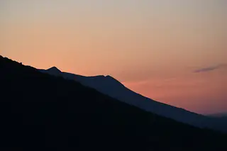
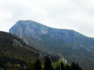
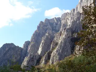
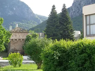
Thirty thousand hectares of karst above Vratsa: the Vratsata gorge, where the road out of town squeezes between vertical limestone; the Ledenika cave; the eco-trail up to the Borov Kamak waterfall; and Okolchitsa, where Hristo Botev's band was destroyed on 2 June 1876. Griffon vultures have been brought back here and are sometimes overhead. Check the park's site for trail closures first.
Story
Background
The park was declared on 21 December 1989 and runs to just over 30,000 hectares across five municipalities — Vratsa, Krivodol, Mezdra, Varshets and Svoge. It holds around eleven hundred vascular plants, some twelve hundred invertebrates, more than 180 birds and around three dozen mammals, and the limestone under all of it is riddled with caves, of which Ledenika is the one fitted out for visitors.
The vultures are the park's long project. Griffon vultures have been reintroduced from an aviary in the hills and are now a regular sight over the cliffs; black and Egyptian vultures turn up too. The park directorate runs a visitor centre, Natura, in Vratsa, and has marked a network of themed walking and cycling routes, including one following the last march of Botev's detachment.
That march is why Bulgarians come. Botev crossed the Danube with two hundred men in May 1876 to raise the country against the Ottomans, was cornered in these hills, and was killed on 2 June near Okolchitsa, the 1,048-metre summit above Vratsa. The anniversary is marked every year. For everyone else the draw is the rock: the Vratsata walls at the mouth of the gorge are the main climbing venue in this part of the country and host an annual meet named after him.
From open data
Dates and details
- Built
- December 21, 1989
- Municipality
- Vratsa
- Area
- 301 km²
English Wikipedia
Vrachanski Balkan Nature Park is a nature park in Bulgaria with an area of 30,129.9 ha established on 21 December 1989.
English Wikipedia · CC BY-SA 4.0
Photographs




Where the information comes from
About & sources
Last checked Sep 17, 2026
Descriptions, recommendations and the audio scripts are written for this guide.
Report a problem