


Vitosha
Витоша

Worth a detour
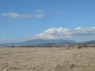
This is the thing about Sofia that no other European capital quite matches. Bus 66 from the Zoo for the Aleko side, or 63 from Tsar Boris III for Zlatni Mostove, and within the hour you are in a nature park under a 2,290-metre summit. A rounded dome rather than a ridge, bare on top, cut by grey rivers of boulders. Take a jacket even in July.
Story
Background
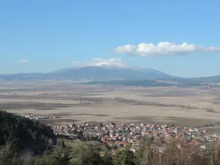
Vitosha sits on a plutonic core — a wedge of intrusive rock thirteen kilometres long and up to nine wide, formed when magma pushed into the crust at the end of the Cretaceous and lifted the ground above it. A ring of andesite around the pluton makes the steep northern faces that rise directly behind the Sofia suburbs of Knyazhevo, Boyana, Dragalevtsi, Bistritsa and Zheleznitsa. The whole massif covers over three hundred square kilometres.
The grey boulder streams pouring off the shoulders — the moreni, most famously at Zlatni Mostove, the Golden Bridges — are the signature of the mountain and are routinely described as glacial moraine. They are not. The park's own geologists put them down to the way the syenite bedrock weathers, splitting in concentric shells like an onion and rounding off each block as water works into the joints. The blocks then creep downhill. Same landform, entirely different cause.
The other things worth knowing are where they are: the Boyana waterfall on the north side, Duhlata cave and the Zhivata Voda spring at Bosnek on the south, Cherni Vrah in the middle. The lifts are the weak point — both the Simeonovo gondola and the Dragalevtsi chairlift have been out of service, the gondola permanently since 2024 — so the buses and the road from Dragalevtsi are how you get up. The last bus down from Zlatni Mostove is 20:00 from April to October and 17:45 in winter.
What this kind of place is
Summit
Bulgarian mountain paths are marked with painted bars on rock and tree — a coloured stripe between two white ones — and the gaps between marks can be long above the treeline. Weather on the high ridges of Rila and Pirin turns fast in any month, and snow lies in the gullies into July.
From open data
Dates and details
- Municipality
- Sofia City
- Elevation
- 2,292 m
- Length
- 19 km
- Area
- 311 km²
- Width
- 17 km
English Wikipedia
Vitosha, the ancient Scomius or Scombrus, is a mountain massif, on the outskirts of Sofia, the capital of Bulgaria. Vitosha is one of the symbols of Sofia and the closest site for hiking, alpinism and skiing. Convenient bus lines and rope ways render the mountain easily accessible.
English Wikipedia · CC BY-SA 4.0
Photographs




Where the information comes from
About & sources
Last checked Sep 16, 2026
Descriptions, recommendations and the audio scripts are written for this guide.
Report a problem