


Verila
Верила

Worth a detour
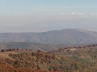
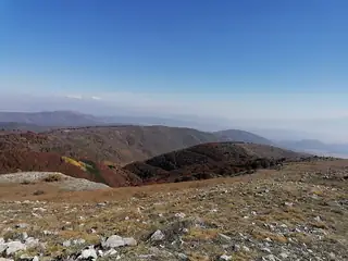
Verila is the hinge between two far more famous mountains: the Bukapreslapska saddle joins it northwards to Vitosha, the Klisura saddle southwards to Rila, and the E4 long-distance path runs straight over the top of it. Twenty kilometres long, gneiss and schist under beech, oak and hornbeam, pasture on the crest, and almost nobody about. Its high point, Golyam Debelets, reaches 1,415 metres.
Story
Background
Nothing here is dramatic, which is the reason to mention it at all. Verila is the piece of ground that makes a continuous walk from Sofia's own mountain into the highest range in the Balkans possible on foot, and walkers on the E4 cross it between Vitosha and Rila without most Bulgarians ever having climbed it.
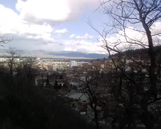
Seven villages sit on its foothills and slopes — Belchin, Klisura, Lisets and Yarebkovitsa on the Sofia side, Gorna Dikanya and Dren in Pernik province, Topolnitsa in Kyustendil. The II-82 road runs through the Klisura saddle at the southern end, so access is easy enough by car if you want to start high.
The forest is deciduous rather than coniferous, which makes it a better autumn mountain than a summer one, and the open pasture along the crest gives views in both directions: Vitosha's dome behind you, the Rila wall in front. If you are not walking a long trail there is no compelling reason to come; if you are, this is the quiet day between two loud ones.
What this kind of place is
Summit
Bulgarian mountain paths are marked with painted bars on rock and tree — a coloured stripe between two white ones — and the gaps between marks can be long above the treeline. Weather on the high ridges of Rila and Pirin turns fast in any month, and snow lies in the gullies into July.
From open data
Dates and details
- Municipality
- Sofia Oblast
- Length
- 20 km
- Width
- 12 km
English Wikipedia
Verila is a mountain range in western Bulgaria with an altitude of 1,415 meters above sea level. It is part of the Ruy–Verila mountain chain. Verila Glacier on Livingston Island in the South Shetland Islands, Antarctica is named after it.
English Wikipedia · CC BY-SA 4.0
Photographs




Where the information comes from
About & sources
Last checked Sep 17, 2026
Descriptions, recommendations and the audio scripts are written for this guide.
Report a problem