


Veleka River Mouth
Устие на река Велека

Worth a detour
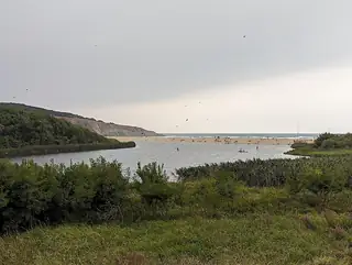
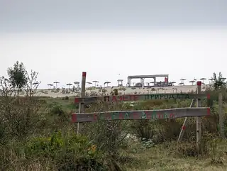
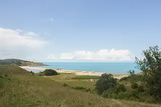
The Veleka rises in Turkey, runs a hundred and forty-seven kilometres through Strandzha, and finishes here by turning sideways behind a sandbar about five hundred metres long before it reaches the sea. You can swim in the river on one side and the sea on the other, thirty metres apart. It is the most photographed landscape on the Bulgarian coast and it deserves to be.
Story
Background
The mouth has been a protected site since September 1992, covering just over fifteen hundred hectares across three villages, taking in the valley, the bar and part of the coast. Three rock formations at the mouth have names — the Sphinx, the Doves and the Split Rock. Together with Silistar it forms a wetland complex of national importance.
The legal frame is what shapes a visit. Navigating any vessel on the river is prohibited from the fifteenth of September to the fifteenth of June. Between those dates only organised tourist trips are allowed, from the mouth upstream to the locality called the Tsar's Well, with a maximum of four boats on the route, a speed limit of four knots and a ban on fuel or oil pollution. One operator runs the trips from a jetty under the iron bridge on the Tsarevo–Sinemorets road: an hour and a half, about €15 for an adult and €6 for a child under ten, at fixed hours through the day.
Fishing is restricted but not banned — sport angling is allowed between the mouth and the bridge at Sinemorets, excluding eel and carp. There is no prohibition on swimming in the river. Note, though, that an illegal sewage collector discharged into the bay between the two Sinemorets beaches for thirteen years until it was stopped in 2021, and no official bathing-water data for the river was available when this was written.
What this kind of place is
Protected area
A protected area under Bulgarian law. What that permits varies enormously by category — a strict reserve may not be entered at all without written permission, while a protected locality is walked and grazed as usual. Check the sign at the boundary rather than assuming.
From open data
Dates and details
- Built
- September 1, 1992
- Area
- 15 km²
Photographs




Where the information comes from
About & sources
Last checked Sep 17, 2026
Descriptions, recommendations and the audio scripts are written for this guide.
Report a problem