


Sinemorets
Синеморец

Worth a detour
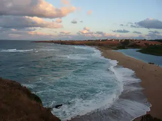
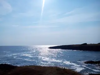
Sinemorets has the best-known beach in the country — the one where the Veleka runs into the sea across a sandbar — and a second, Butamyata, in a sheltered bay to the south. It is small, twenty kilometres from Tsarevo and eleven from the Turkish border, and in July it holds several times its population. Come in June or late September, and do not expect facilities.
Story
Background
The village sits between the Veleka and the frontier, with the Strandzha forest at its back. Its two beaches have separate registers, separate concessions and wildly separate prices: an umbrella at Butamyata costs about three euros, one on the Veleka mouth beach about ten, which is the highest published rate on the Bulgarian coast. Two further beaches south of the village, Lipite and Listi, are officially unguarded and have no lifeguards at any time of year.
The development history matters here more than anywhere else on this coast, because it is still going on. The whole Veleka mouth is a protected site of over fifteen hundred hectares, declared in 1992. In 2020 building was permitted at a locality above the beach and protests followed, with a petition of several thousand signatures. In 2021 the national building control body banned construction in the village over an illegal sewage collector that had been discharging into the bay between the two beaches for thirteen years. In 2025 the municipality accepted a ruling that a concrete foundation on Butamyata beach counted as a building and set a removal deadline. In June 2026 the environment inspectorate stopped a paid campsite behind the same beach and gave the operator two weeks to restore the ground.
None of that spoils the swimming, and some of it explains what you will see. Boat trips up the Veleka are legally possible only between the fifteenth of June and the fifteenth of September. Carry cash: card acceptance is patchy this far south.
From open data
Dates and details
- Municipality
- Tsarevo
- Elevation
- 46 m
- Area
- 28 km²
- Population
- 437 (2025)
Photographs



Where the information comes from
About & sources
Last checked Sep 17, 2026
Descriptions, recommendations and the audio scripts are written for this guide.
Report a problem