


Pirin
Пирин

Worth a detour
Rila is higher; Pirin is steeper. Eighty kilometres of ridge running north to south, with the two highest summits — Vihren at 2,914 m and Kutelo just behind it — packed into the northern end, where the rock turns to marble and the walls go nearly vertical. Most of the range is national park, on the World Heritage list since 1983. Bansko is the usual base. The marble is karst: it swallows water, and long stretches of the high ridge have no springs.
Story
Background
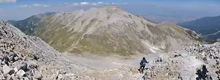
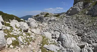
Pirin runs about eighty kilometres from the Predel saddle in the north, where it meets Rila, down towards the Greek border, and it is narrow — forty kilometres at the widest, often far less. The northern third is the part people mean when they say Pirin. Here the granite gives way to a band of marble, and marble weathers into the shapes that make the range look, from Bansko, more like a small alpine chain than anything else in the country: knife ridges, screes of white gravel, walls that drop several hundred metres without a ledge.
The national park covers most of the high ground and has been a World Heritage site since 1983, with an extension added in 2010. It holds around 118 glacial lakes, of which Popovo, in the middle of the range, is the largest and deepest. Two areas were deliberately left outside the inscription: the ski zones above Bansko and Dobrinishte. Those exclusions have been the subject of a long argument between the Bulgarian state, conservation groups and the World Heritage Committee, which has repeatedly asked for lift development to be reined in. You see the evidence of it on the drive up.
The practical consequence of all that marble is dryness. Karst takes rain straight down, and on the high crests between the huts there can be nothing to drink for hours. Fill up at the hut, and treat any summer afternoon above 2,500 m as likely to end in a storm.
What this kind of place is
Summit
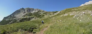
Bulgarian mountain paths are marked with painted bars on rock and tree — a coloured stripe between two white ones — and the gaps between marks can be long above the treeline. Weather on the high ridges of Rila and Pirin turns fast in any month, and snow lies in the gullies into July.
From open data
Dates and details
- Elevation
- 2,914 m
- Length
- 80 km
- Area
- 2,585 km²
- Width
- 40 km
English Wikipedia
The Pirin Mountains are a mountain range in southwestern Bulgaria, with the highest peak, Vihren, at an altitude of 2,914 m (9,560 ft). The range extends about 80 km (50 mi) from the north-west to the south-east and is about 40 km (25 mi) wide, spanning a territory of 2,585 km2 (998 sq mi). To the north, Pirin is separated from Bulgaria's highest mountain range, the Rila Mountain, by the Predel saddle, while to the south it reaches the Slavyanka Mountain.
English Wikipedia · CC BY-SA 4.0
Photographs




Where the information comes from
About & sources
Last checked Sep 17, 2026
Descriptions, recommendations and the audio scripts are written for this guide.
Report a problem