


Most south - eastern point of European Union in continental Europe
Най-югоизточната точка на Европейския съюз в континентална Европа

Worth a detour
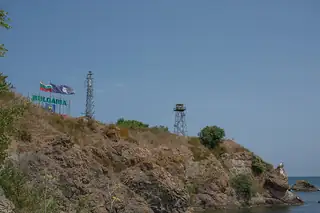
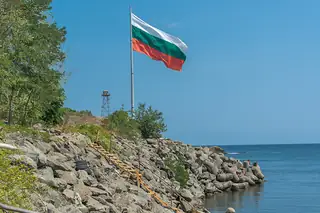
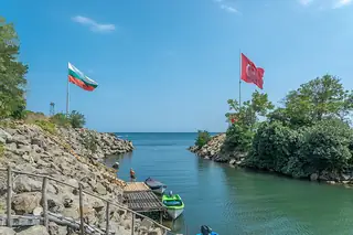
The Rezovska river is the Bulgarian–Turkish border along its whole length, and the village at its mouth is the last settlement on the coast: fifty-eight people at the last count, fifteen kilometres south of Ahtopol, ninety-three from Burgas. It is claimed as the south-easternmost point of the European Union, which is true only of the mainland. Go for the end-of-the-road feeling; there is nothing else.
Story
Background
Be precise about the claim, because Tsarevo's own website is not. Rezovo is the southernmost point of Bulgaria's Black Sea coast, which is straightforwardly true. It is the south-easternmost point of the EU mainland, which is also true. It is not the south-easternmost point of the European Union — Cyprus lies further east and further south — and it is not the southernmost point of Bulgaria, which is a peak in the eastern Rhodopes three quarters of a degree further down.
There is no border crossing here. The three operating checkpoints on the Turkish frontier are at Kapitan Andreevo, Lesovo and Malko Tarnovo; a pedestrian crossing at Rezovo has been talked about for years and does not exist. What that means in practice is that the road ends, and the other bank of a small river is a country you cannot walk into.
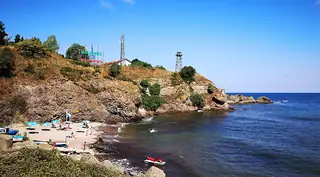
Two beaches, Rezovo and Rezovo-Kastrich, are officially unguarded all season with no concession and no prices. Three kilometres north on Cape Kastrich are the remains of a small rectangular fortress, twenty metres by thirty, probably the medieval Kastrition. The border police check identity documents of everyone entering the village, so carry a passport. And your phone will very likely latch onto a Turkish network and start roaming while you are still standing in Bulgaria — turn data off before you get here.
What this kind of place is
Boundary stone
A cut stone marking an old border — between two villages, two estates, or two states. Bulgaria's borders moved repeatedly between 1878 and 1947, and stones from the frontier with Ottoman Turkey, with Romania across the Dobruja, and with Serbia and Greece still stand where the line used to run.
From open data
Dates and details
- Inscription
- Най-югоизточната точка на Европейския съюз в континентална Европа Most south - eastern point of European Union in continental Europe
Photographs



Where the information comes from
About & sources
Last checked Sep 17, 2026
Descriptions, recommendations and the audio scripts are written for this guide.
Report a problem