


Malyovitsa
Мальовица

Worth a detour
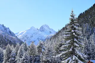
At 2,729 m Malyovitsa is not among Rila's highest, but it is the most recognisable — a steep granite pyramid at the head of its own valley, and the training ground of Bulgarian mountaineering since the middle of the last century. From the hut at about 1,960 m the walk is three to four hours up and two to three down on a well-trodden path, with a rocky last section. No technical climbing on the summer route; sure feet, though.
Story
Background
The valley road climbs from Govedartsi to a small ski centre at around 1,730 m, and that is where cars stop. The hut is another half-hour above, at roughly 1,960 m, just at the treeline, and from its terrace the peak is the obvious pointed thing at the head of the cirque. Bulgarian alpinism effectively began on the walls around here; the mountaineering school in the valley trained several generations of climbers, including members of the country's Himalayan expeditions.
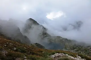
The ordinary route is a path, not a climb. It works up through meadow and boulder to the shoulder, then steepens into rock steps for the last stretch — nothing that needs a rope in summer, but enough that you will use your hands and want dry conditions. Three to four hours up is realistic for someone who walks regularly; the descent is quicker on the legs and harder on the knees.
Malyovitsa is also a junction. From the ridge, marked paths run north-east towards the Seven Rila Lakes and south-west down to Rila Monastery, which makes it the standard first day of a traverse rather than simply a summit. That also means the hut fills up in season. In June there is often still snow in the gullies under the peak, and the rock steps are considerably worse wet than dry.
What this kind of place is
Summit
A named summit. Bulgarian mountain paths are marked with painted bars on rock and tree — a coloured stripe between two white ones — and the intervals between marks can be long above the treeline. Weather on the high ridges of Rila and Pirin turns fast in any month, and snow lies in the gullies into July.
From open data
Dates and details
- Municipality
- Kyustendil
- Elevation
- 2,729 m
English Wikipedia
Malyovitsa is a peak in the northwestern part of the Rila Mountain in southwestern Bulgaria. It is 2,729 m (8,953 ft) high and is one of the most popular tourist regions in the mountain. Its northern and eastern slopes are steep and almost inaccessible while the southern and south-western slopes are more oblique.
English Wikipedia · CC BY-SA 4.0
Photographs




Where the information comes from
About & sources
Last checked Sep 17, 2026
Descriptions, recommendations and the audio scripts are written for this guide.
Report a problem