


Kom Peak
Ком

Worth a detour
2,016 metres above Berkovitsa, with the Danube plain laid out to the north — the town at your feet, Montana and the Ogosta reservoir thirty kilometres out. It is the western end of Kom–Emine, the ridge route that crosses Bulgaria to the Black Sea, so half the people here are starting something long. As a day out it is a straightforward two hours from the hut on grass.
Story
Background
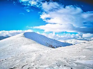
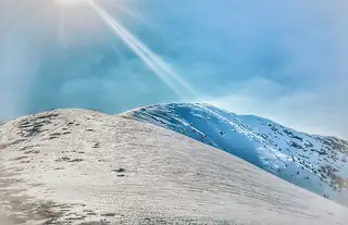
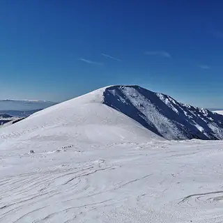
Kom is the high point of the Berkovitsa mountain, one section of the Western Balkan range: a rounded grass summit with a steep stony north slope and a gentle south one, forming a short west–east ridge with Sreden Kom and Malak Kom beside it. Fifteen kilometres of asphalt climb from Berkovitsa to the Kom hut, and that is where most walks begin; on foot the road takes about three and a half hours, which is a waste of a morning.
From the hut the marked path crosses the saddle between Malak and Sreden Kom and then turns west along the ridge — around two hours, no difficulty, and nothing to hide behind if the weather turns. Longer ways up come from the Petrohan pass, about three and a half hours on the red Kom–Emine markings, and from the villages of Komshtitsa and Gintsi, about three.
The view north is the thing. Ivan Vazov wrote a poem about it, and there is a stone slab near the summit marker carrying his portrait in relief and lines from it — a small, slightly pompous monument that is nonetheless a fair response to what you can see from up there.
From open data
Dates and details
- Municipality
- Montana
- Elevation
- 2,016 m
English Wikipedia
Kom Peak or Golyam Kom is a peak in the western Balkan Mountains, located in western Bulgaria, not far from the Serbian border. The peak is 2,016 metres high and lies south of the town of Berkovitsa, of which it is a traditional symbol. Kom, along with the lower peaks Sreden Kom ("Middle Kom") and Malak Kom ("Little Kom") to the east, form a west–east elevation with a round grassy ridge, a steep rocky northern slope and a slant grassy southern slope.
English Wikipedia · CC BY-SA 4.0
Photographs



Where the information comes from
About & sources
Last checked Sep 17, 2026
Descriptions, recommendations and the audio scripts are written for this guide.
Report a problem