


Cape Emine
Емине

Worth a detour
Cape Emine is the eastern tip of the Stara Planina, the point where a mountain chain that begins on the Serbian border runs out of land. It is fifty-five kilometres north of Burgas, with the ruins of the medieval fortress of Emona on it, a lighthouse, and the finish of the Kom–Emine trail, the Bulgarian section of the European long-distance route E3.
Story
Background
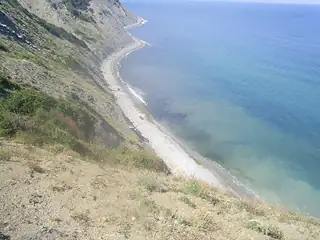
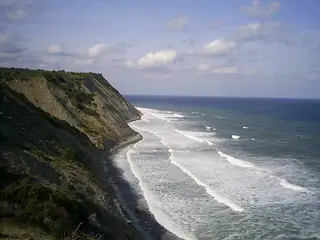
The cape divides the Bulgarian coast in two. North of it the shore is cliff and bay; south of it, in Burgas Bay, it is sand, lagoon and salt. Everything about the two halves of this coast follows from that, and the cape is where you can see the change.
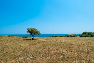
It is a low headland, only about fifteen metres at the point, and it has a reputation as the stormiest cape in Bulgaria. On it are the ruins of Emona, a medieval fortress whose name comes from the ancient Aemon, and a former monastery; the village of Emona sits behind it. A lighthouse works there still.
For walkers this is the end of the line. The Kom–Emine route runs the length of the Balkan range from the Kom peak above Berkovitsa to this cape, some six hundred kilometres of ridge, and is the classic Bulgarian long walk; the European E3 uses it. Arriving at Emine on foot after two or three weeks is one of the set pieces of Bulgarian hiking, and the cape is generally occupied by two or three people who have done exactly that.
For everyone else it is a drive to Emona and a walk out to the point. There are no facilities. The coast immediately north is the Irakli protected area and then Karadere, two of the least developed stretches left in the country, and the whole of it is inside Natura 2000 bird and habitat zones.
From open data
Dates and details
- On
- Black Sea
English Wikipedia
Cape Emine is a headland located at the Bulgarian Black Sea Coast. It is located 79 kilometres (49 mi) south of Varna, 55 km (34 mi) north of Burgas and 14 km (9 mi) south of Obzor. It forms the tip of Stara Planina.
English Wikipedia · CC BY-SA 4.0
Photographs




Where the information comes from
About & sources
Last checked Sep 17, 2026
Descriptions, recommendations and the audio scripts are written for this guide.
Report a problem